Day 147 (Mile 2643.8 to Northern Terminus)

image

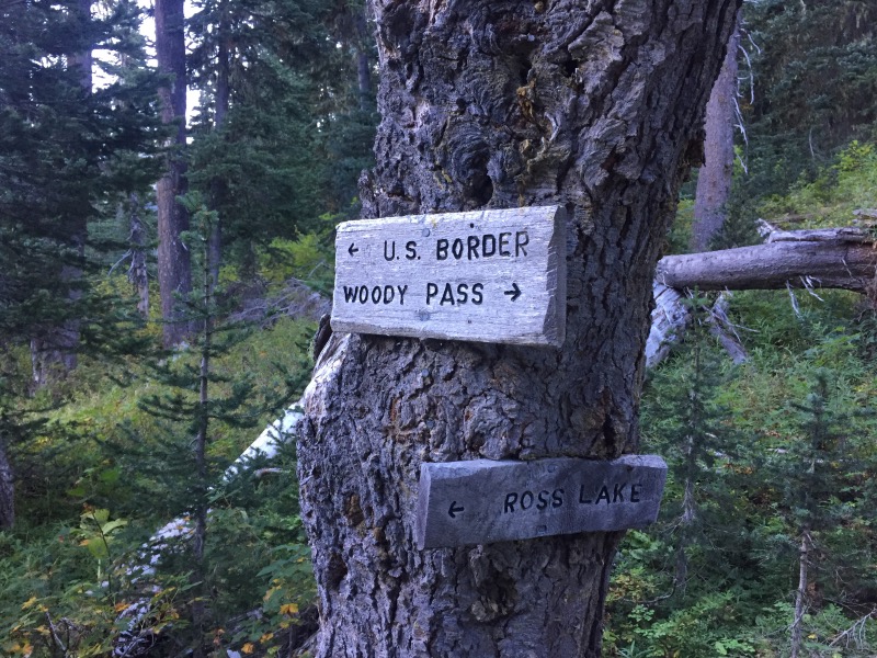
Rob woke up a few times during the night to the sound of deer munching grass near our tent. My head was wrapped in several layers (beanie, buff, jacket hood and sleeping bag) because temperatures have been dropping into the 30’s at night. I heard nothing. Continue reading “Day 147 (Mile 2643.8 to Northern Terminus)”

Days 143 to 146 (Miles 2569.4 to 2643.8)

image

We left Stehekin on the first shuttle at 8:15 in the morning. The bus made a quick stop at the bakery where almost everyone bought giant cinnamon rolls. The bus was filled with PCT hikers. We spent some time debating how many cinnamon rolls a person would need to consume (if they carried no other food) to successfully hike the remaining 80 miles to the Canadian border. There was no consensus. Continue reading “Days 143 to 146 (Miles 2569.4 to 2643.8)”

Days 137 to 142 (Miles 2467.3 to 2569.4)

image

We heard from other hikers that Washington has a lot of steep ups and downs. This was definitely the case for the section of trail between Stevens Pass and Stehekin. We climbed 5500 to 6500 feet every day. We still managed to cover between 20 and 27 miles per day. We’re not in a hurry, but we can only carry 4 to 5 days worth of food. Hiker hunger. Continue reading “Days 137 to 142 (Miles 2467.3 to 2569.4)”

Days 133 to 136 (Miles 2390.6 to 2467.3)

image

There are two trails leaving Snoqualmie Pass: the PCT and the Goldmyer Hot Springs Alternate. Most of the alternate trails we’ve taken have been well worth it. With this in mind we were tempted to hike the Goldmyer Alternate, but after researching it a little, it didn’t seem like a good option. The hot springs are owned by a nonprofit dedicated to offering a wilderness experience to the public while preserving the springs. This is great, but use of the area is limited to 20 people per day and it is extremely difficult to get a reservation on short notice. Additionally, we read that the Goldmyer trail itself is rocky, steep, overgrown and generally more challenging than the PCT. Continue reading “Days 133 to 136 (Miles 2390.6 to 2467.3)”

Days 126 to 128 (Miles 2226.4 to 2292.4)

image

It took a few phone calls to find a ride from Trout Lake back to the trailhead. The town has a trail angel list: names and phone numbers of people willing to shuttle hikers back and forth. The first few people we called were busy preparing for the upcoming town fair, but eventually we got ahold of Gary, who met us a few minutes later at the grocery store. Continue reading “Days 126 to 128 (Miles 2226.4 to 2292.4)”

Days 122 to 125 (Miles 2144.2 to 2226.4)

image

We crossed the Columbia River on Bridge of the Gods. The bridge has two lanes and no sidewalks. The woman in the toll booth gave us (somewhat obvious) instructions to walk single file, facing traffic. It was a Sunday morning and there was a lot of traffic on the bridge. We walked quickly. Continue reading “Days 122 to 125 (Miles 2144.2 to 2226.4)”

Days 120 & 121 (Miles 2094.5 to 2144.2)

image

We left Timberline Lodge after eating their legendary breakfast buffet. Between the two of us, we had cheesy eggs, frittata, a biscuit, apple fritter pancakes with berries and whipped cream, several fresh baked pastries, sausage links and patties, ham, breakfast smoothies, yogurt with granola, cherries and watermelon. We didn’t have room for waffles. Continue reading “Days 120 & 121 (Miles 2094.5 to 2144.2)”

Days 112 to 115 (Miles 1904.1 to 1981.3)

image

The trail gets progressively more scenic going north from Shelter Cove. We crossed Highway 58 near Willamette Pass and soon we were hiking in the forest, past the many lakes within the Willamette National Forest and Three Sisters Wilderness. The mosquitos were pretty bad, but with our head nets on, they mostly didn’t bother us. Continue reading “Days 112 to 115 (Miles 1904.1 to 1981.3)”